SafeTogether
Presentation file
SafeTogether - An application to inform, prevent, protect and care people about the natural disasters in French Antilles

SafeTogether - An application to inform, prevent, protect and care people about the natural disasters in French Antilles
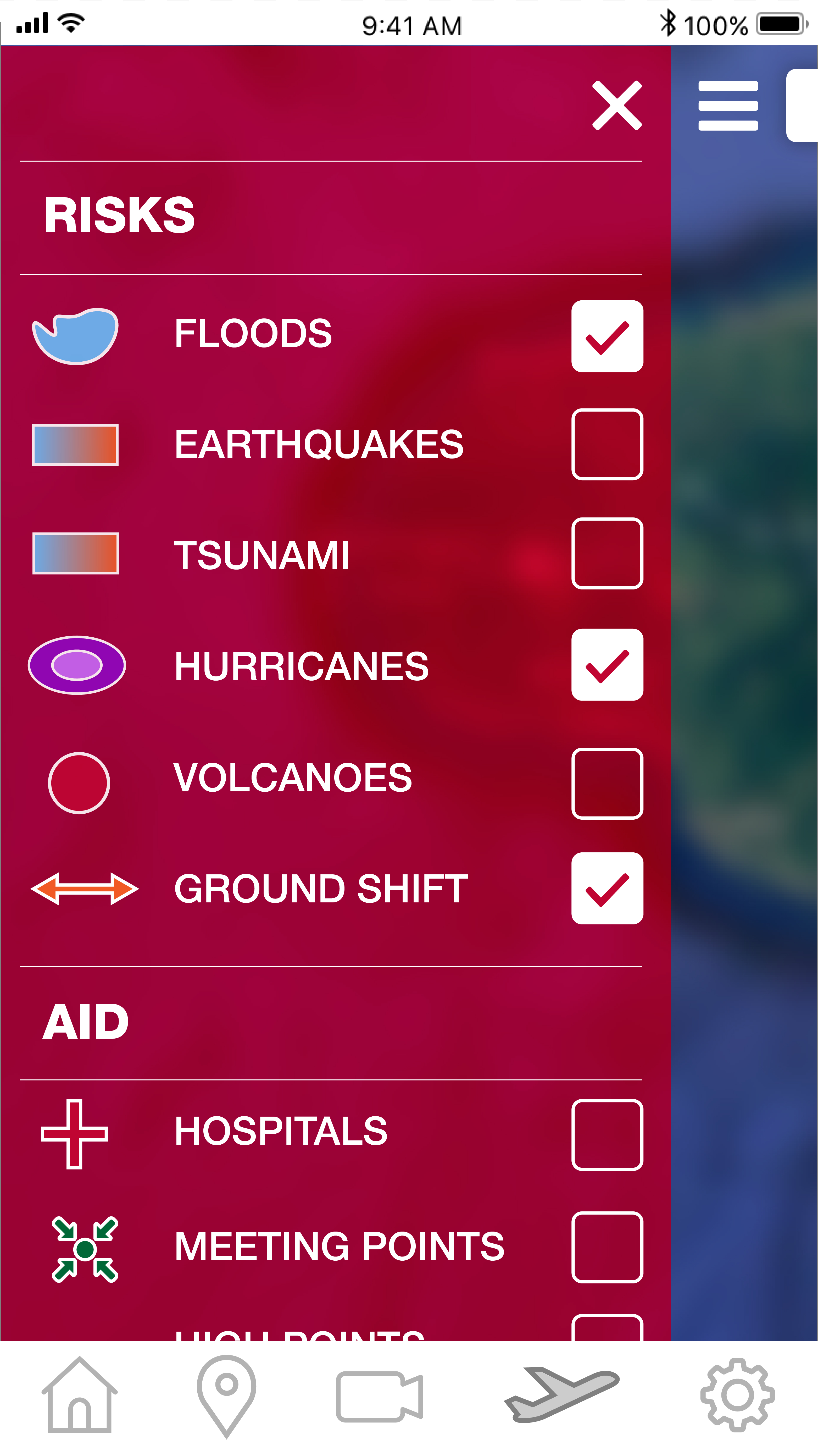
The application will be design in 3 sections :
The citizens are the first actor of their security and that is the reason why they have many ways easy to reach for being informed about the risks to whom they are exposed. A lot of information is available and at citizens’ disposal, at the town hall for instance, such as the DDRM (Dossier Départemental des Risques Majeurs) or the PPRN (Plan de Prévention des Risques Naturels) but the datas are too disseminated and not really practical, not really easy to understand and it does not allow a quick look.
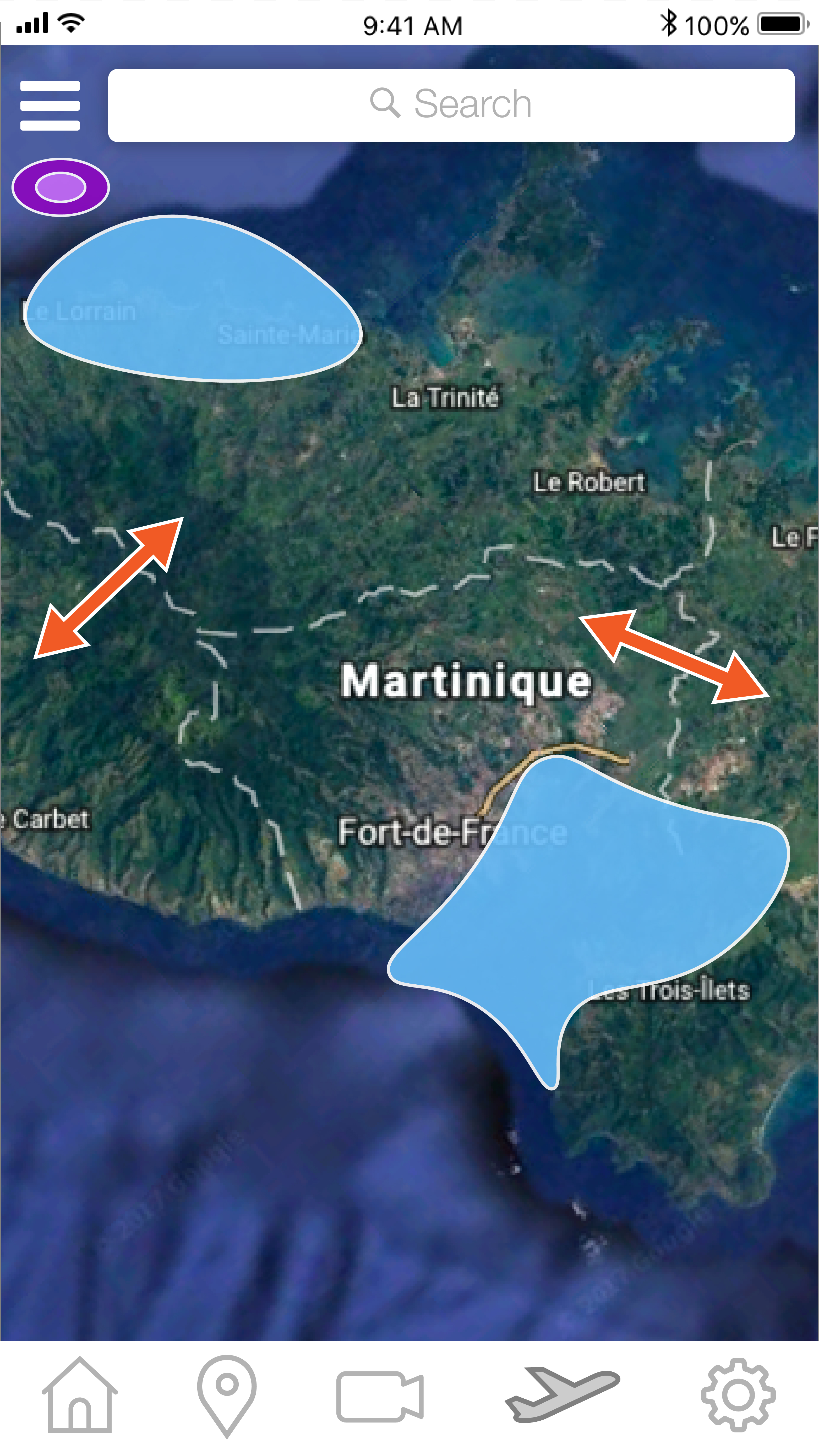
The dynamic cartography will help people to better show the data about the riskiness and it will allow to have an intuitive understanding of the risks. It’s not only in order to prevent, it’s also in order to educate people and help them to be more awareness of their living conditions. When you tape the region you are going in, it gives you the natural risks link to this region and also indicate the person shelters, hospitals and so on. It’s a collection of information and datas in only one app !
The risk prevention is crucial in the French Antilles for many different reasons. But first and foremost, most of the cities in Guadeloupe, Martinique, Saint-Martin or Saint-Barthélemy are situated on the coast because of the topography of the islands. By consequences, the populations are really exposed and it is absolutely vital for them to know perfectly not only the potential natural hazards, but also how to react in front of them or just before/after.
From a geological point of view, the French Antilles are situated in a context of convergence of two tectonic plates : the North-American plate and the Caraïbe plate. At the level of the volcanic arc of the Antilles, the North-American plate plunges under the Caraïbe plate, at a rate of 2 cm/year. It is called a « subduction ». This convergence is characterized also by many earthquakes, more or less deep. On the earth, the subduction zones are really defined by their important seismic and volcanic activities, with some earthquakes that could reach an intensity above 9 on the Richter scale, as the one of 2004, near to Sumatra (Indonesia). This specific situation explains the fact that the island arc of the Antilles is an area with a high probability of volcanic eruptions, earthquakes and also tsunamis.
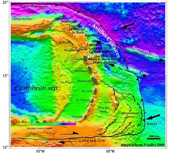
Schematic map : « The island arc of the Antilles in the context of plate tectonics »
Source :D. Bertil, S. Bazin, D. Mallarino, F. Beauducel. Séisme des Saintes, rapport de synthèse, Centre de Données Sismologique des Antilles, 8 décembre 2004.
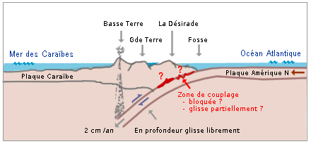
Interpretative model: « The seismic and volcanic activity link with subduction under the French Antilles »
Source: M. Corsini, Nice Sophia-Antipolis University.
The seismic risk is one of the most apprehended in terms of potential victims. Every year, more than 150 seisms of a magnitude higher than or equal to 6 on the Richter scale happened in the world. And concerning the French Antilles, as we said previously, the position at the frontier of two tectonic plates of the Guadeloupe and Martinique islands reinforce the risk. Currently, the scientific are waiting for the « Big One », a huge earthquake, which could occur soon, but no one could say exactly when.
Moreover, with the earthquakes there is sometimes a tsunami, more or less important, and the prevention of that is not really efficient on the French Antilles. Firstly, it doesn’t really exist a risky knowledge about tsunami such as for earthquakes or hurricanes for instance. This situation can be explained with the fact that tsunamis are really less present in the region than hurricanes. According to Meteo France, there is a frequency of 0,06 tsunami/year, whereas for the hurricanes it is 0,4/year, which means that the frequency is seven times higher for hurricanes than for tsunamis.
The Islands of the Antilles have a tropical climate (warm and wet), which is favourable for the development of hurricanes. The hurricanes are a major risk for the French Antilles. Because of the straight of the natural phenomenon, and despise the progress of science in understanding, observation and prevention, the hurricanes are still every year at the origins of huge and terrible human costs and economic costs. We had an example of this with Irma hurricane in september 2017 for instance.

source: Europe 1, NHS, ©SOPHIE RAMIS,PAUL DEFOSSEUX / AFP
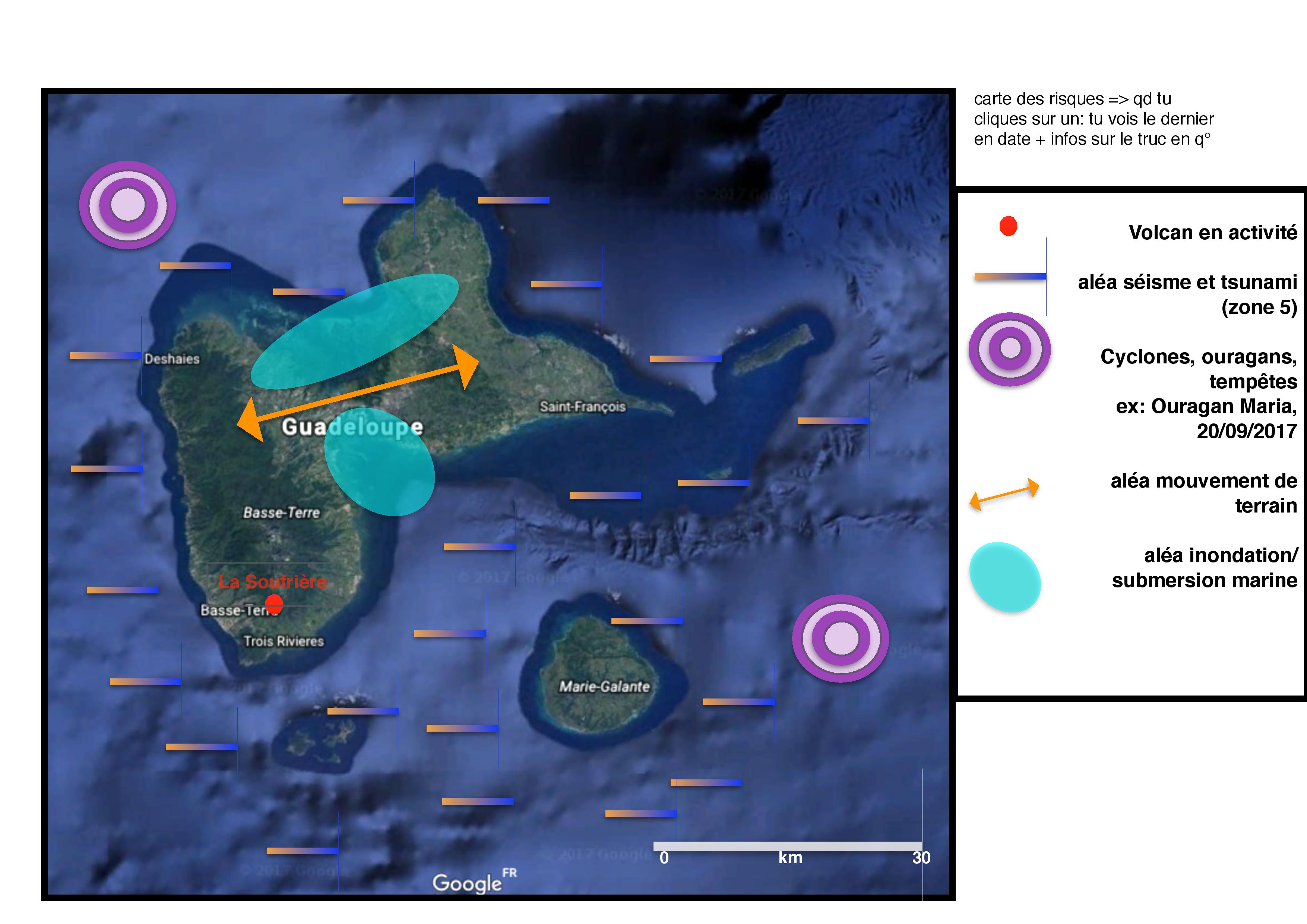
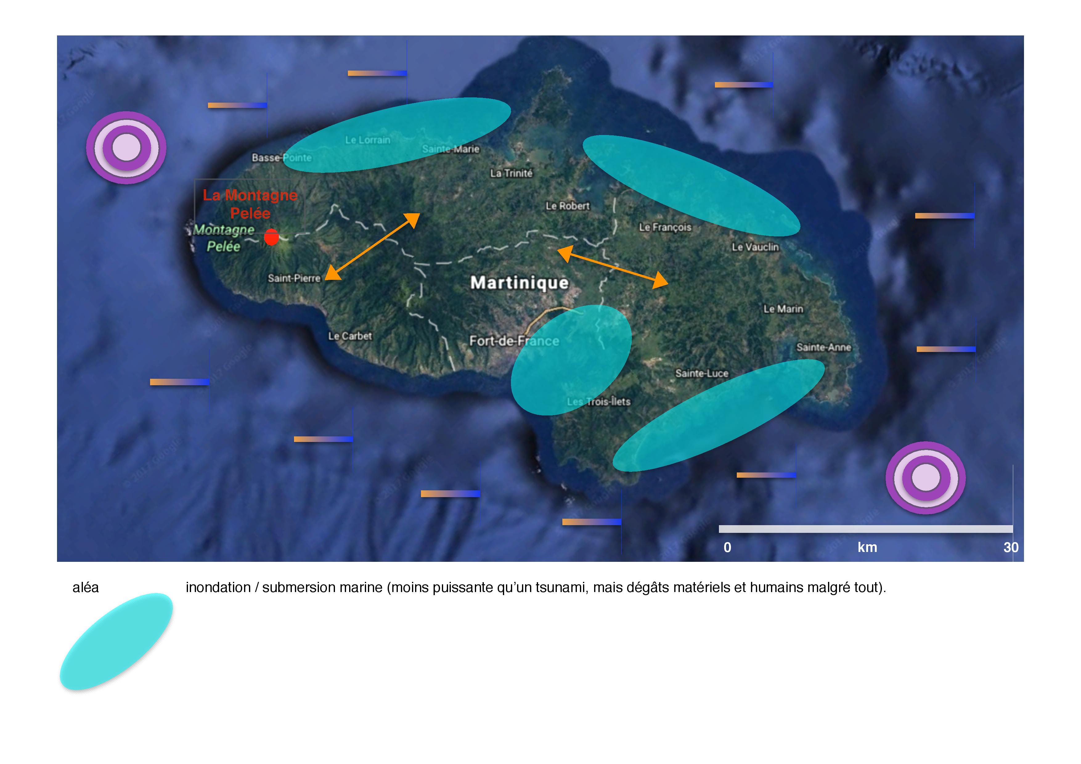
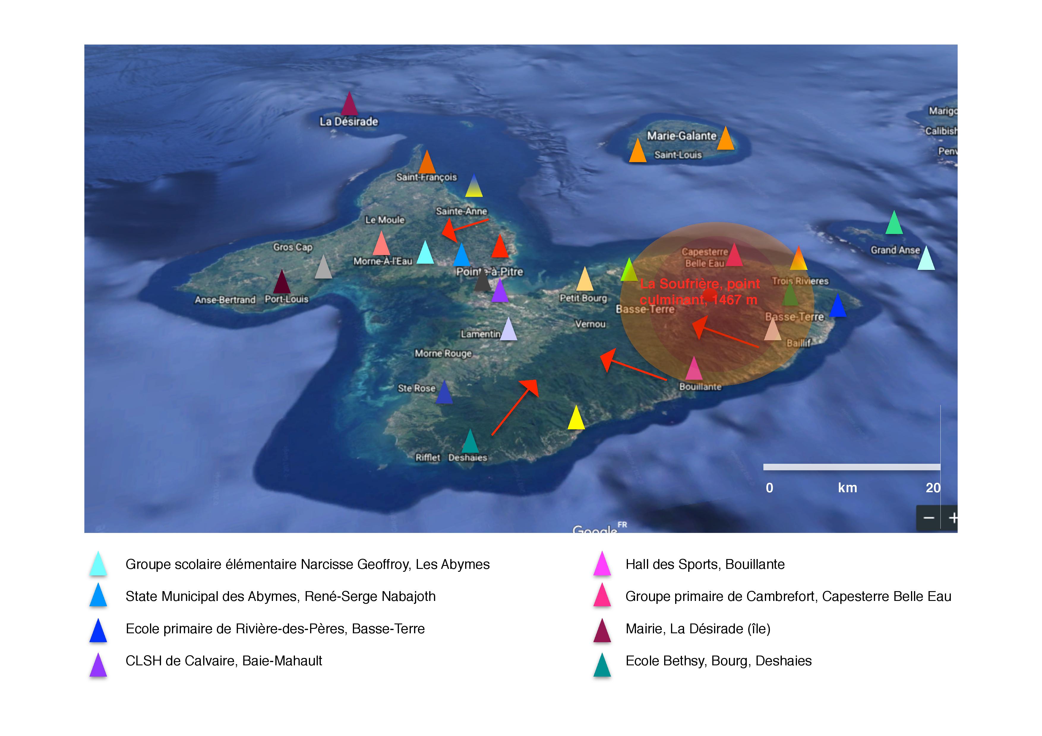
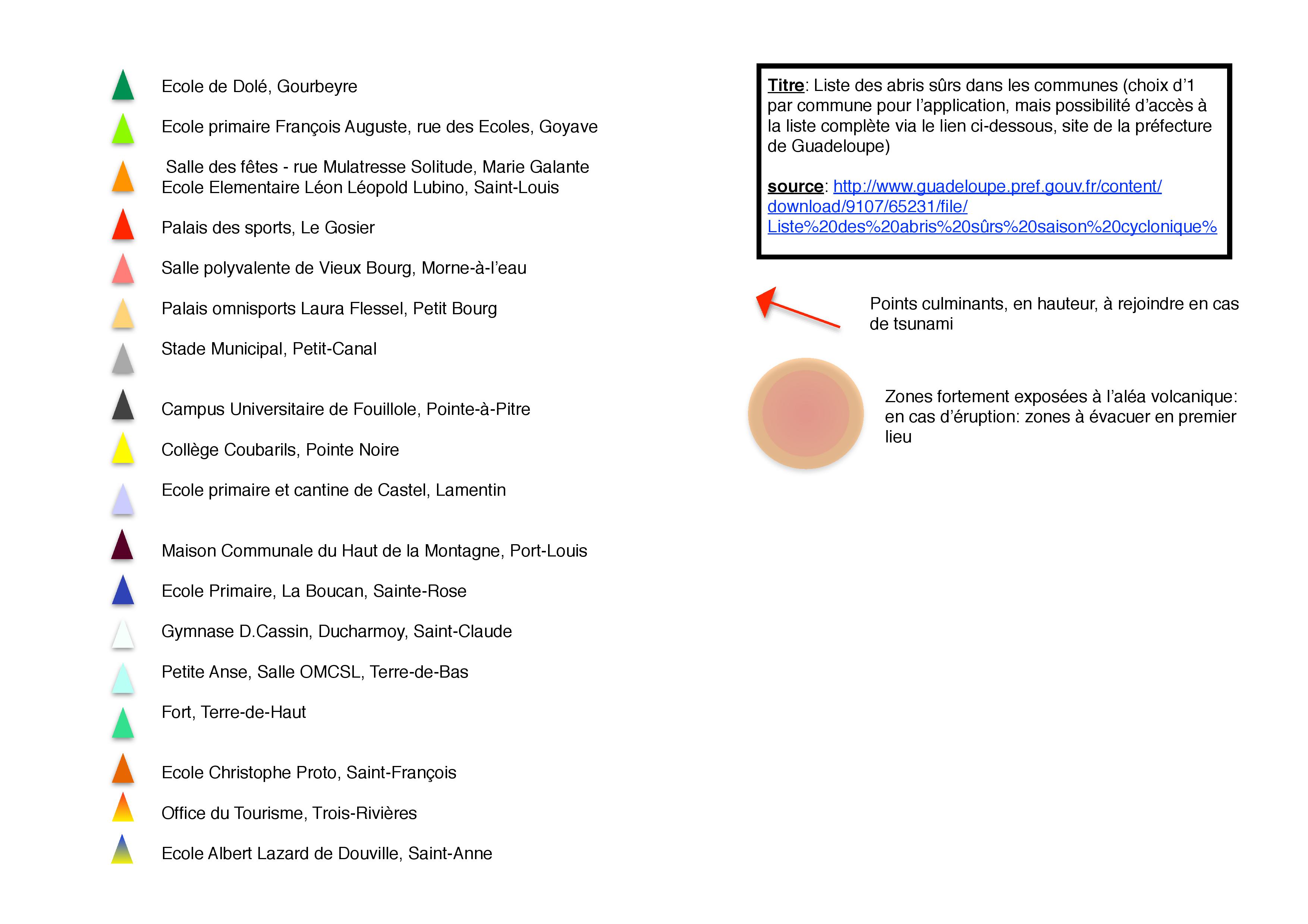
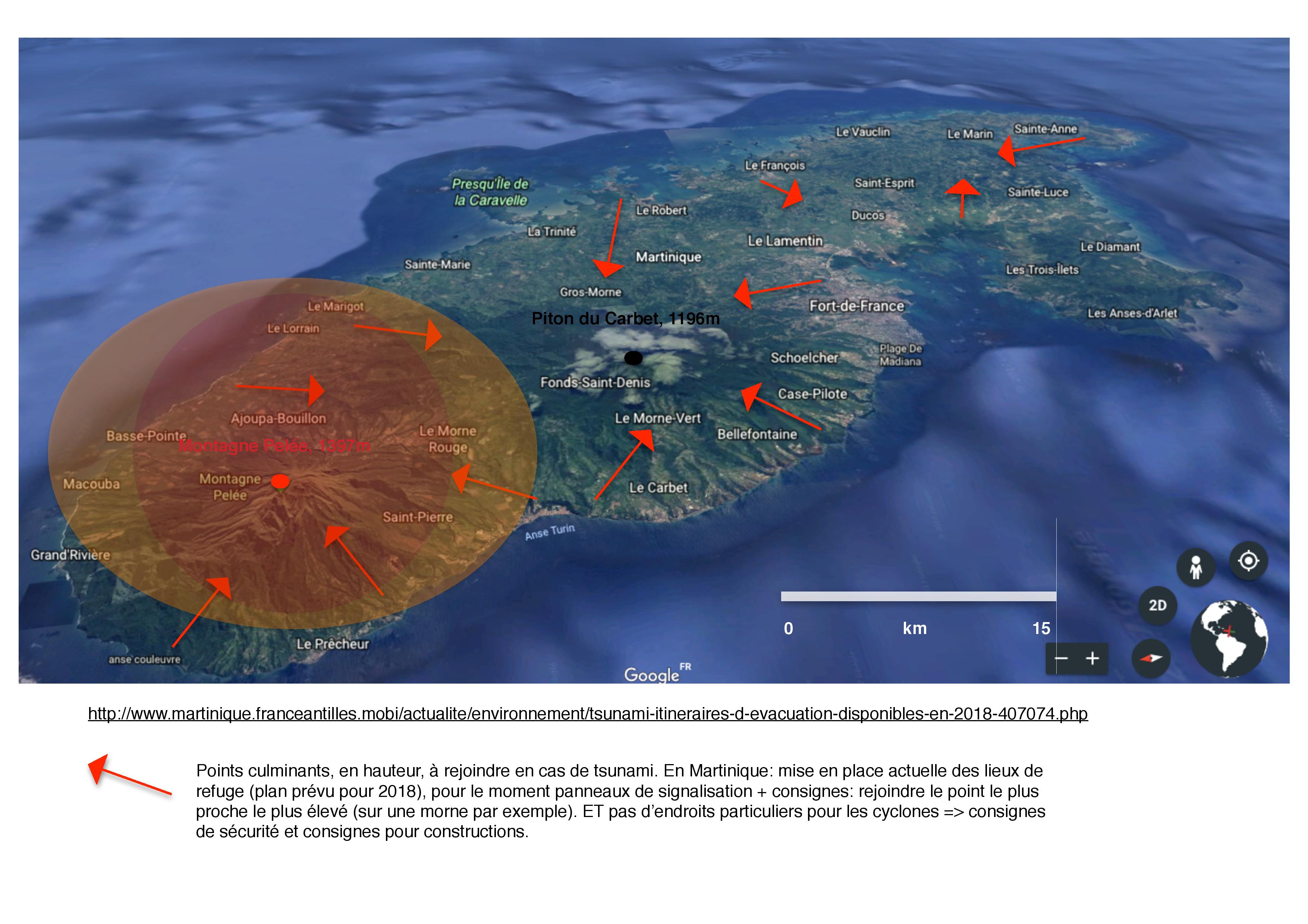
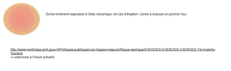
Furthermore, the volcanic eruption is also an important natural hazard in Guadeloupe, with the « Soufrière » volcano and in Martinique, with the « Montagne Pelée » volcano, which threat directly more than 200 000 people. The following illustrations show the importance of the dangerous zone in case of volcanic eruption.

source: DDRM of Guadeloupe, 2014 (Dossier Départemental des Risques Majeurs)

source: DDRM of Martinique, 2013
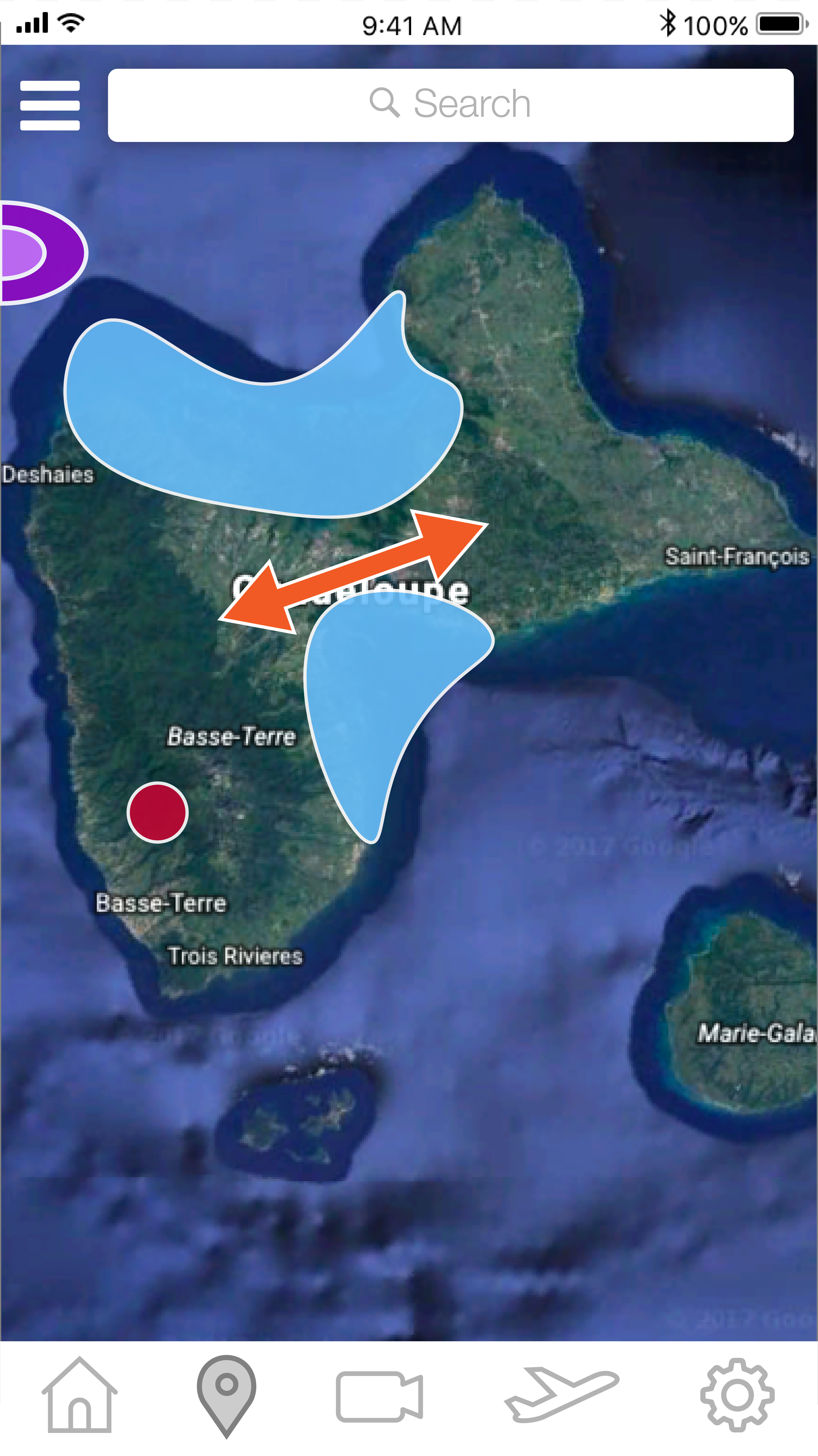
1st: Finding a relevant background for the app:
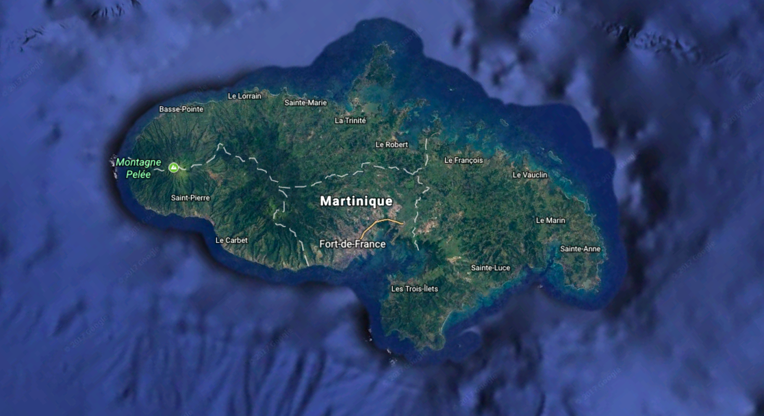
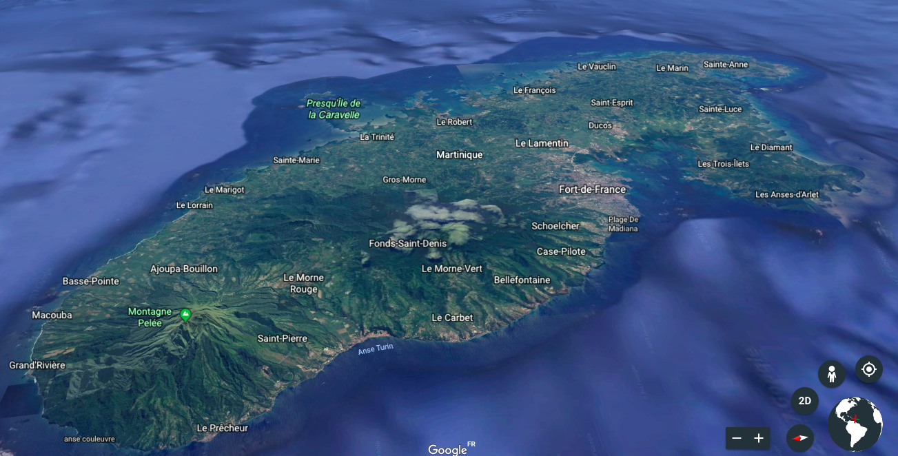
We decide to use Google Earth maps for our background, because it is quite precise and it allow different point of views (2D, 3D). We used screenshots.
For instance, with Martinique Island:
2D:
3D
2nd: Finding the data concerning the risks (which turned out to be more complicated than planned !):
At the beginning of our researches, we thought that we could find easily some datas about the risks in the French Antilles, such as on data.gouv or on the website « Géorisques ». But quickly, we met some difficulties, in particular with « Géorisques ». Indeed, it functions perfectly for every city in metropolitan France, but when you begin to search many accurate details about the French Antilles, the website turns in the air but give you nothing about it. So we have to do very accurate researches, on the prefecture websites, scientific websites such as the website of the International Tsunami Information Center (ITIC), CataNat, the website of the « Observatoire volcanologique et sismologique de Martinique », etc. We also have to read the DDRM (Dossiers Départementaux sur les Risques Majeurs) in order to better understand the specific situation of the French Antilles. Finally, we have a lot of disseminated information, but very useful to map the risks.
3rd: Creating the risk maps for each island:
Firstly, we did a first draft, with some details in order to help the work of digitalization.
First draft: the risk mapping of Guadeloupe:
First draft: the risk mapping of Martinique
First draft: the risk mapping of Saint-Martin
First draft: the risk mapping of Saint-Barthélemy
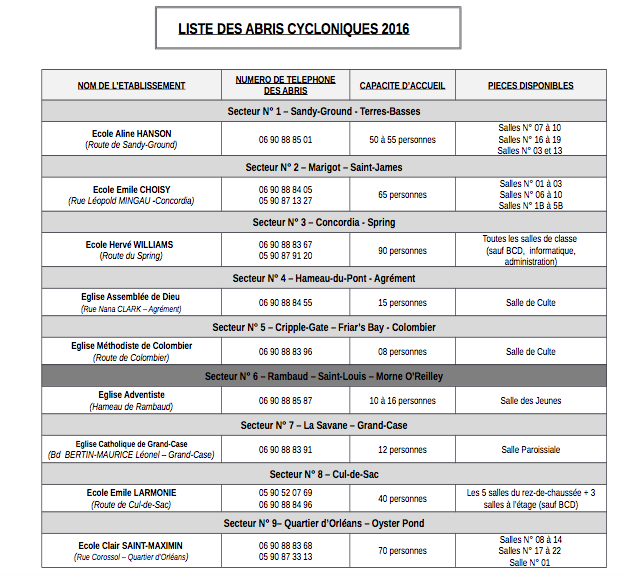
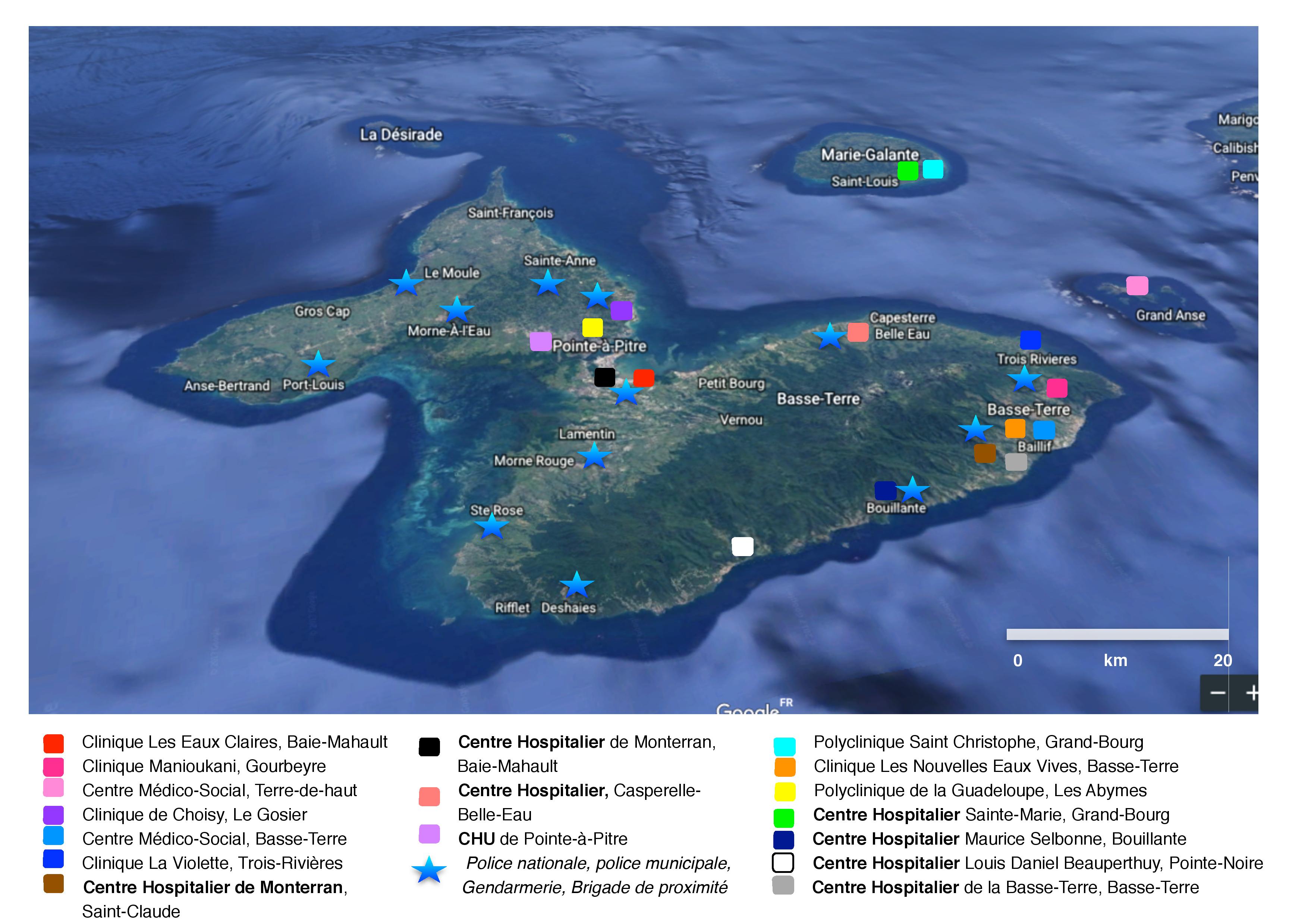
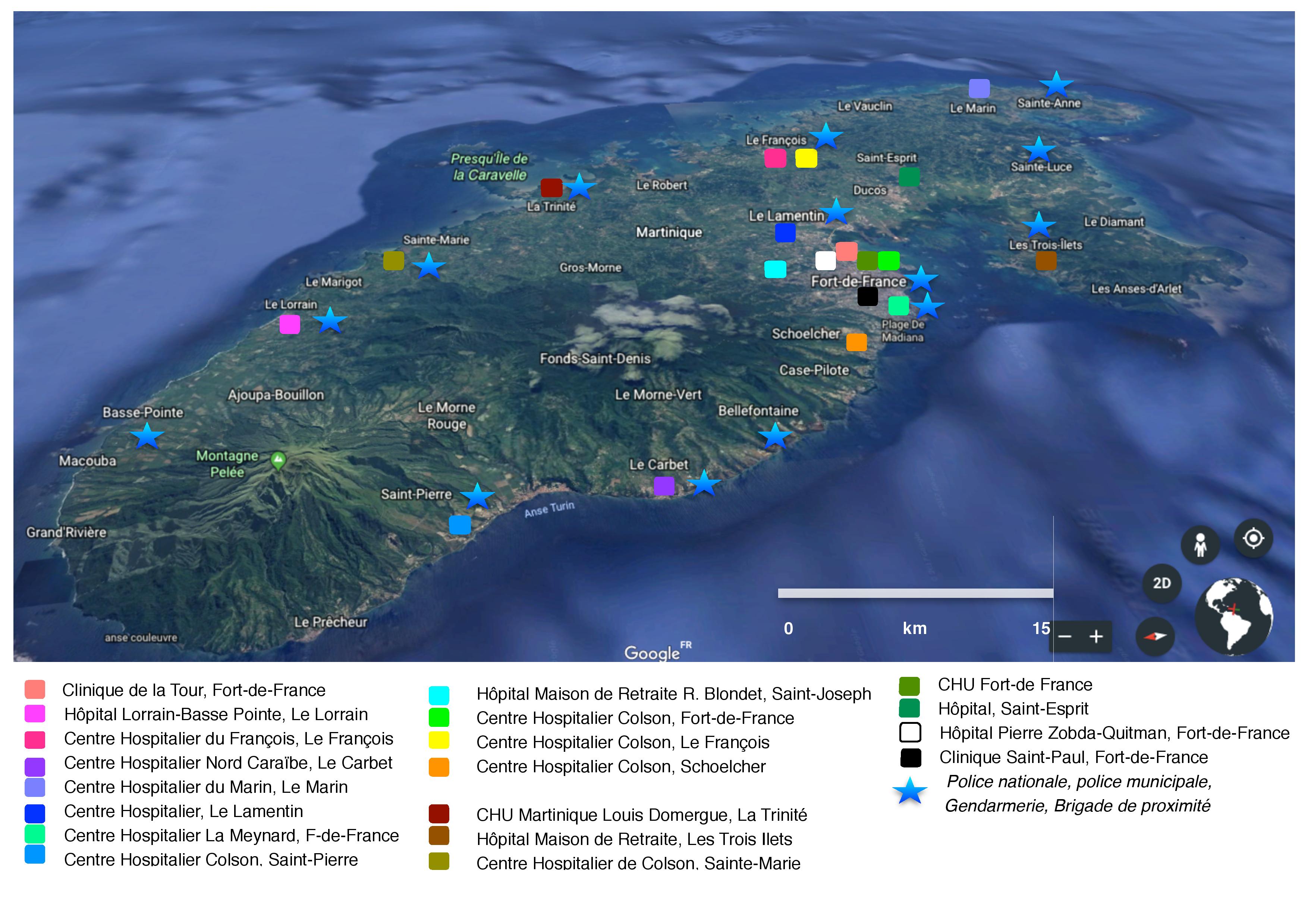
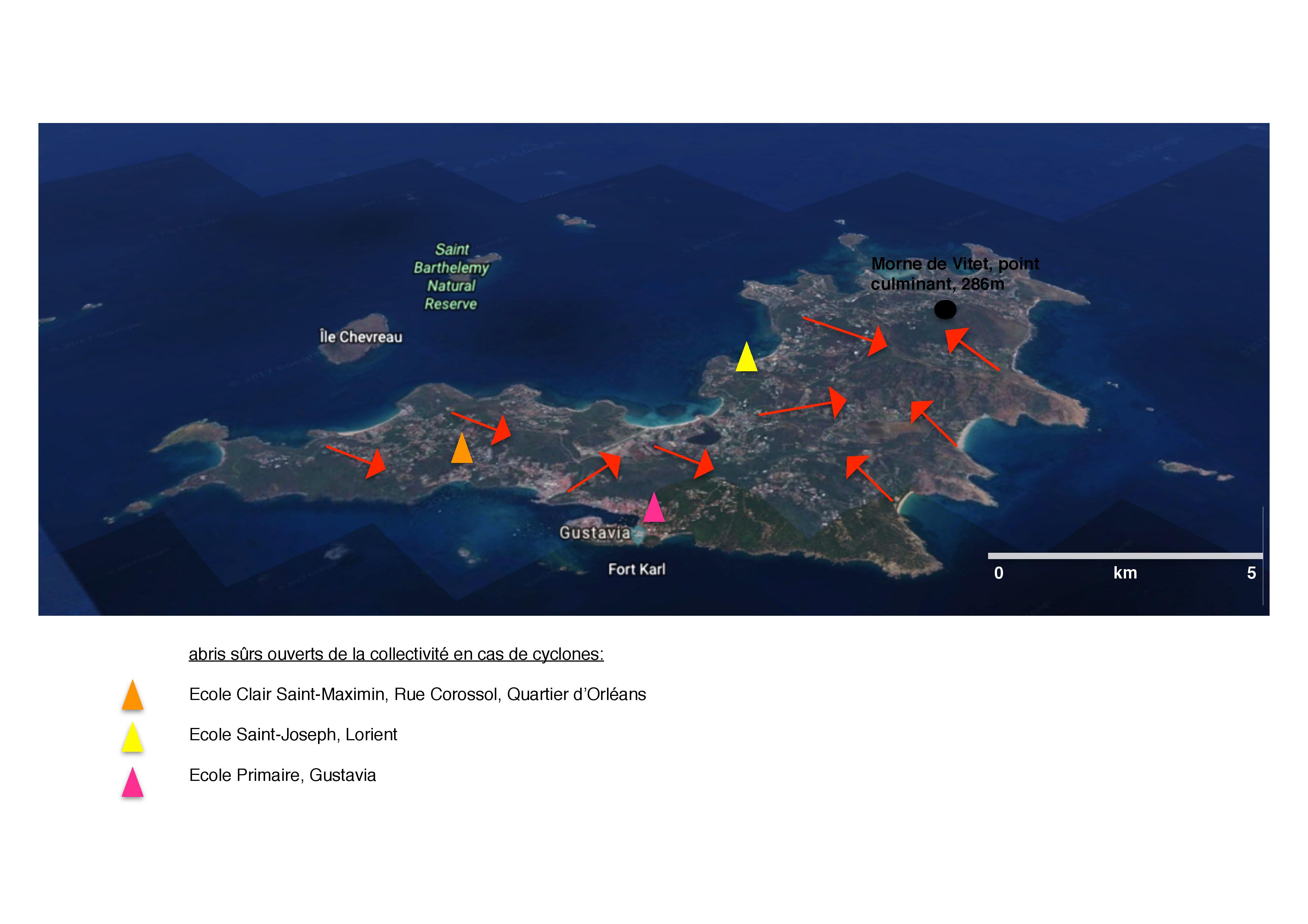
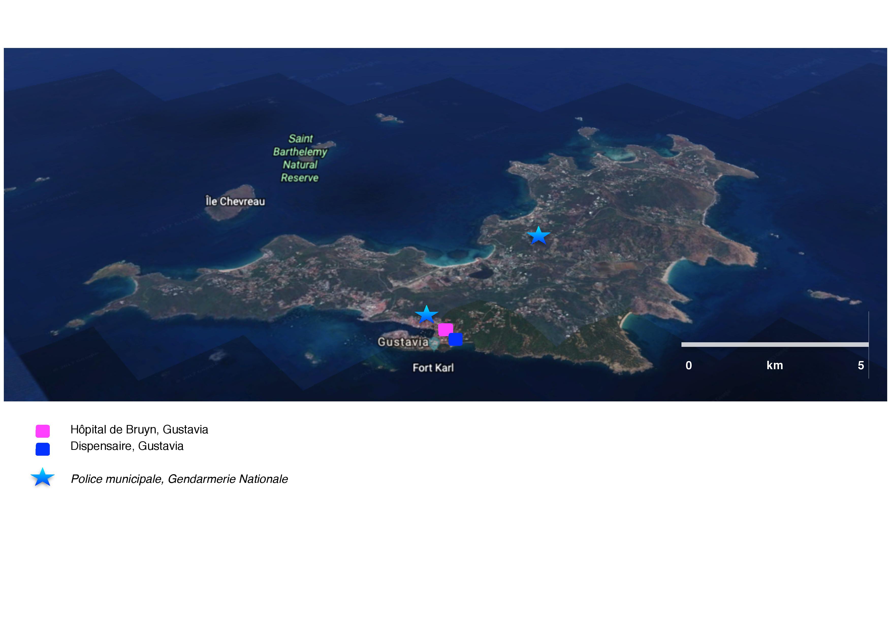
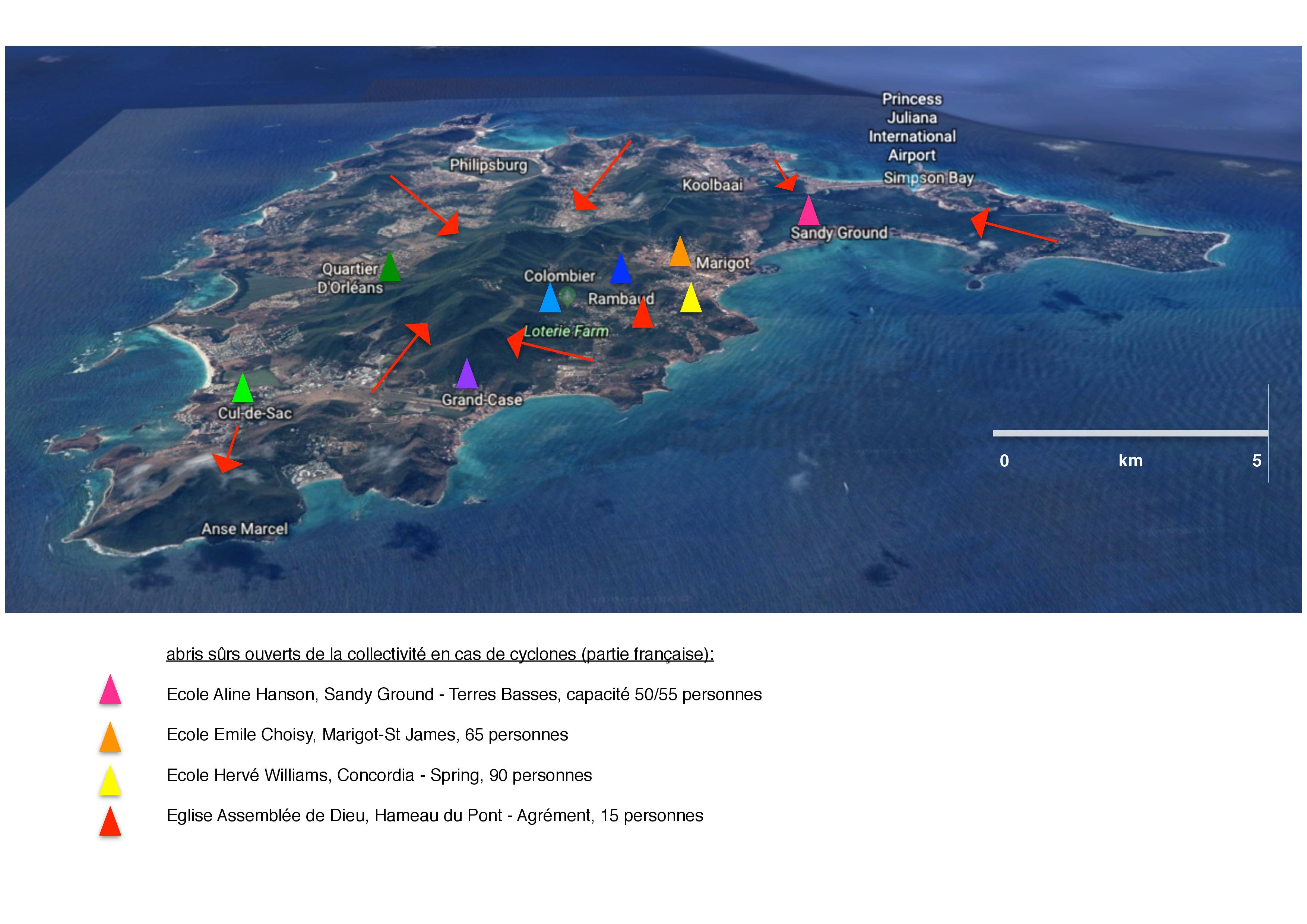
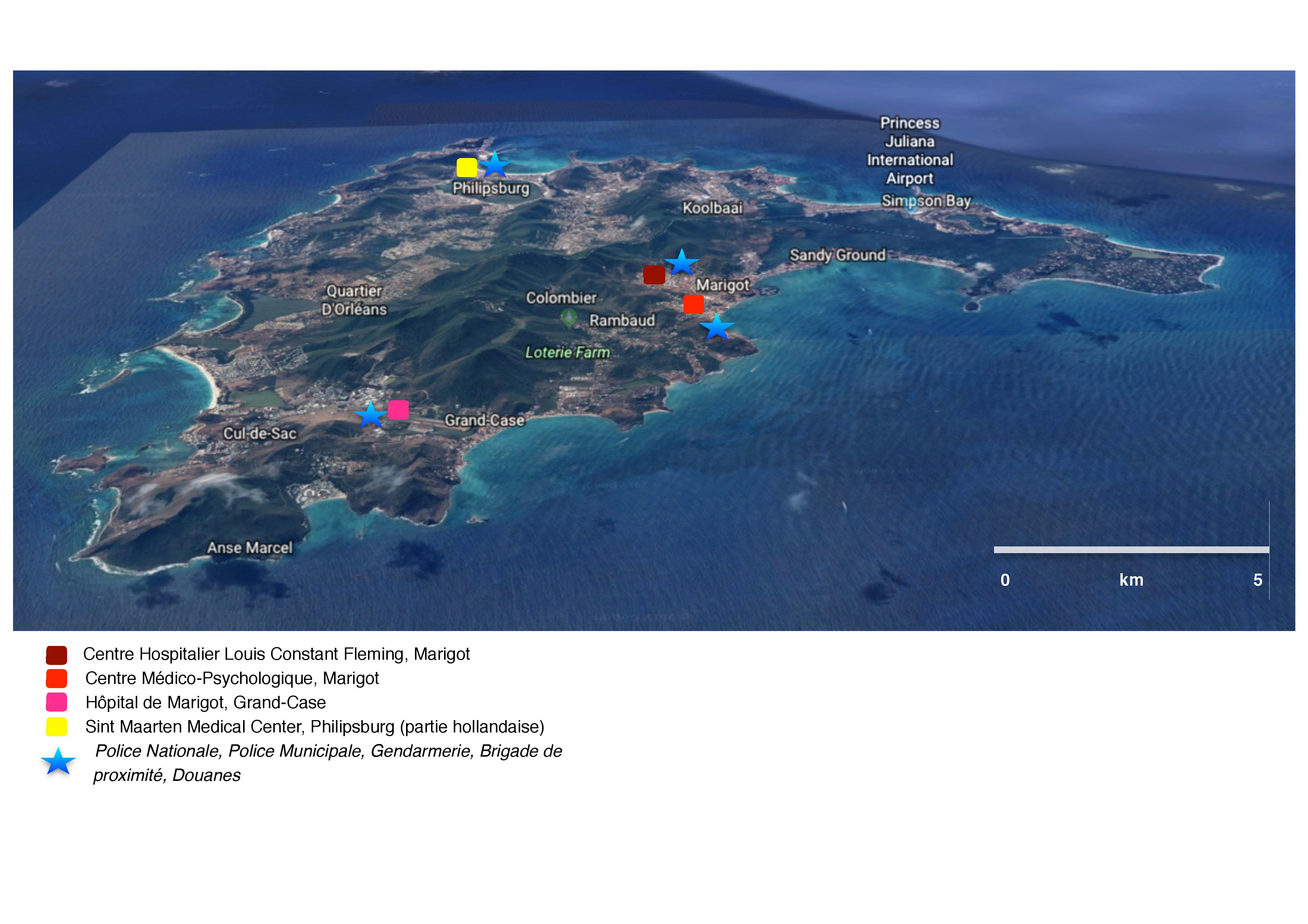
4th: Finding the data concerning the helping services ( complicated too):
As for the datas concerning the risks, the documents about the shelters in case of tsunamis or hurricanes, the meeting points, the safe zone, the hospitals or the police stations are numerous but different and nothing was on the same document. The DDRM and the websites of the prefectures were really helpful, and Google Maps too, to better visualize some data in order to put them correctly on the map.
For instance, we used this kind of documents, found on the Saint-Martin / Saint-Barthélemy websites in order to know the hurricanes shelters and after we compare the address with Google Maps in order to put in on the map.
5th: Creating the helping maps for each island:
first drafts of Guadeloupe:
first drafts of Martinique:
first drafts of Saint-Barthélemy:
first drafts of Saint-Martin:
6th: Digitizing and embellishing all the maps for the application:
After this work of creation, we give our maps a more practical aspect for our application, through the digitalization:
7th: Preparing the texts and the data linked with the maps for the application:
1.Definitions
Natural Hazards : It’s the manifestation of a natural phenomenon with a particular occurrence and intensity.
Stake: All the people and the goods that are likely able to be affected by a natural phenomenon.
Natural risks: A violent or extreme natural phenomenon, of meteorological, geological or climatic origins, that could go off anywhere on earth. We call it a natural disaster when people’s lives and goods are destroyed.
Major risk: The risk is the combination of a hazard and the vulnerability of a stake, such as the presence of a population. The seriousness of the risk depends of the intensity and the probability of the hazard to occur and of the vulnerability and the exposure of the stakes. The major risk is the consequence of a natural hazard or human one, of which the effects could bring into play many people’s lives, bring about huge damages and exceed the ability to react of the societies and of the government.
Tsunami: It’s a series of huge waves created by an underwater disturbance such as an earthquake, a submarine volcanic eruption or the fall in sea of big pieces of cliffs or glacier. It causes important damages when it breaks out on a coast. Around 85% of the tsunamis have for origin an earthquake, but an earthquake doesn’t necessarily trigger a tsunami. A tsunami can cross the ocean and comes from a seism which is not feel in the area. The natural signals of a tsunami are:
Volcanic eruption: A volcanic eruption happens when lava and gas are discharged by a volcano because of the pressure. There are different kind of volcanic eruptions (effusive volcanoes and explosive volcanoes). The most dangerous is the volcanic explosion: the magma is formed with hot pyroclastic flow from rock fragments (up to 1200 degrees).
Hurricane: It’s a strong low-pressure, which is born generally above warm water (above 26°C) in the tropical wet zone (550 km far from the equator) and which is characterized by very violent winds (could reach 350 km/h) and torrential rains. It is an enormous cloud, in spiral. It could have a radius from 500 to 1000 km. The « eye of the hurricane », the center zone, is the most dangerous one.

source: government website, risk prevention
Ground Shift: It’s a movement, more or less sudden, from the soil or the subsoil. It gathers different phenomenons: the landslide, the pile of rubble or the collapse of underground cavity for example. These movements are punctual but they are still a major risk, because of their huge human and material consequences.
Earthquakes: An earthquake is a consequence of a fracturing along a fault. The breach leads to a sudden release of a huge amount of energy, which is conveyed in surface by vibrations more or less important of the soil.
Floods: An overflow of a large amount of water beyond its normal limits, especially over what is normally dry land.
2.Last in date:
Guadeloupe:
Volcanic eruption:
Seism:
Tsunami:
Hurricane:
Martinique:
Volcanic eruption:
Seism: more than 600 earthquakes / year, one of the area where the risk is stronger.
Tsunami: strong risk
Hurricane:
Saint-Martin:
Seism:
Tsunami:
Hurricane:
Saint-Barthélemy:
Seism:
Tsunami:
Hurricane:
3.Useful tips:
Guadeloupe:
Martinique:
Saint-Martin:
Saint-Barthélemy:
Prefecture of Saint-Barthélemy
The video tutorials aim to respond to three commitments of Safe Together which are inform, prevent and protect citizens.
There will be three different categories of videos, that will cover the knowledge about natural disasters to first actions to take :
The aim is that every citizen in the region knows what is a seism, what is a hurricane and so on to better prepare themselves. Information about the environment is a key to a successful protection campaign against natural disasters.
What are the basics to have in a house in French Antilles? What are the best anti seismic materials? Which precautions are necessary to take when you live in a risky area?
What are the first aid gestures? How to handle stress in such situation? What are the right people to contact?
No matter the different category of the videos, the tutorials will be simple, accessible and short. The length of the videos will remain between 2-4 minutes.
In the long term, if Safe Together would expend in others countries, the idea would be to provide with the same videos but in different languages.
Many French associations such as Sikana, the Red Cross, provide with very simple videos to understand the basics of natural disasters. The idea is to create several partnerships to incorporate already existing videos on Safe Together application. For the example, here is an example of a video (provided by Sikana) to explain how to get prepared when a seism is coming :
This video is a good example of a tutorial that would be integrated in the section TUTOS in the category: Prevent from natural disasters. How to react ?
In the case, there is a lack of videos concerning a specific topic, Safe Together will take the responsibility to create new tutos. For example, our team design a tutorial to teach what are the basic in a first aid kit. You can find the video on YouTube :
One of the aims of SafeTogetger is to enable your smartphone -a device no one leaves anymore- to be a tool for you when a natural disaster occurs. First, it can help you have the good behaviour in order to protect yourself and others. But it can also be a way for rescue services to locate where you are if you are in danger, or for you to inform these services you don’t need help (and enable them to focus on other victims).
The problem is, concerning natural disasters, that it is very difficult to know what resources would be still working. Indeed, the mobile phone network, could be damaged, like any other device of this kind. Another limitation is the average smartphone. If we want our app to be efficient and useful, it has to be well spread and thus, to be suitable with a large majority of smartphone currently used. A study showed that almost 62% of the population of West Indies-Guyana region had used their smartphone to surf on the internet but, there is not a lot of studies concerning the technology used although we can assume these devices have a WiFi device or even a Bluetooth device.
Locating victims is one of the biggest challenges for rescue services. Indeed, a very important number of wounds are way more likely to be healed if it is done quickly. Rescue services are currently using numerous detectors (including rescue dogs of course). In France, the areas where this kind of event is the more common are mountains areas. Rescue services are used to look for skiers after avalanche. Avalanche bips are a way to ease their localization. This is an device emitting a special frequency only used for safety reasons. This protected frequency cannot be emitted by smartphones it follows the same scheme than the one we would like our app to offer. Moreover, some researchers thought about using smartphones in case of avalanche.
The team of Mobile Communications Laboratory had the idea of using them to know the position of victims and thus ease a search. Indeed, while WiFi mode is on, the devices emit data packets at regular intervals so that it’s possible to know different parameters, like the power received by the antenna connection. The surrounding terrain, the weather or interference can make it vary.
Another important factor is the thickness of the layer of rubble over a person that make it weaker. Nevertheless, there is little similarity between these signals and a distance in meters that would enable us to know directly the position of the device emitting the signal, and its owner. But in case of natural disaster, we cannot rely on existing antennas in order to receive the data emitted to locate smartphones. With a drone, rescue services could locate the phone with the GPS points of the captured signals from several places. These benchmarks are regarded as the center of circles which could probably find the phone. The intersection of the latter determines where is the phone and, therefore, probably the person.
“By refining the system to automatically eliminate weaker signals, the system has become even more accurate,” explained Jonathan Cheseaux
Here is a video showing the technology:
We would like to make a partnership with this project in order to promote our common solution. In effect, our app would enable any user to press a button “I need help” which activates the Wifi mode and stops the other potential applications and functions in order to save battery autonomy. It would help rescue teams equipped with these new drones.